Dead Woman's Pass
Inca Trail, Peru - Day 17
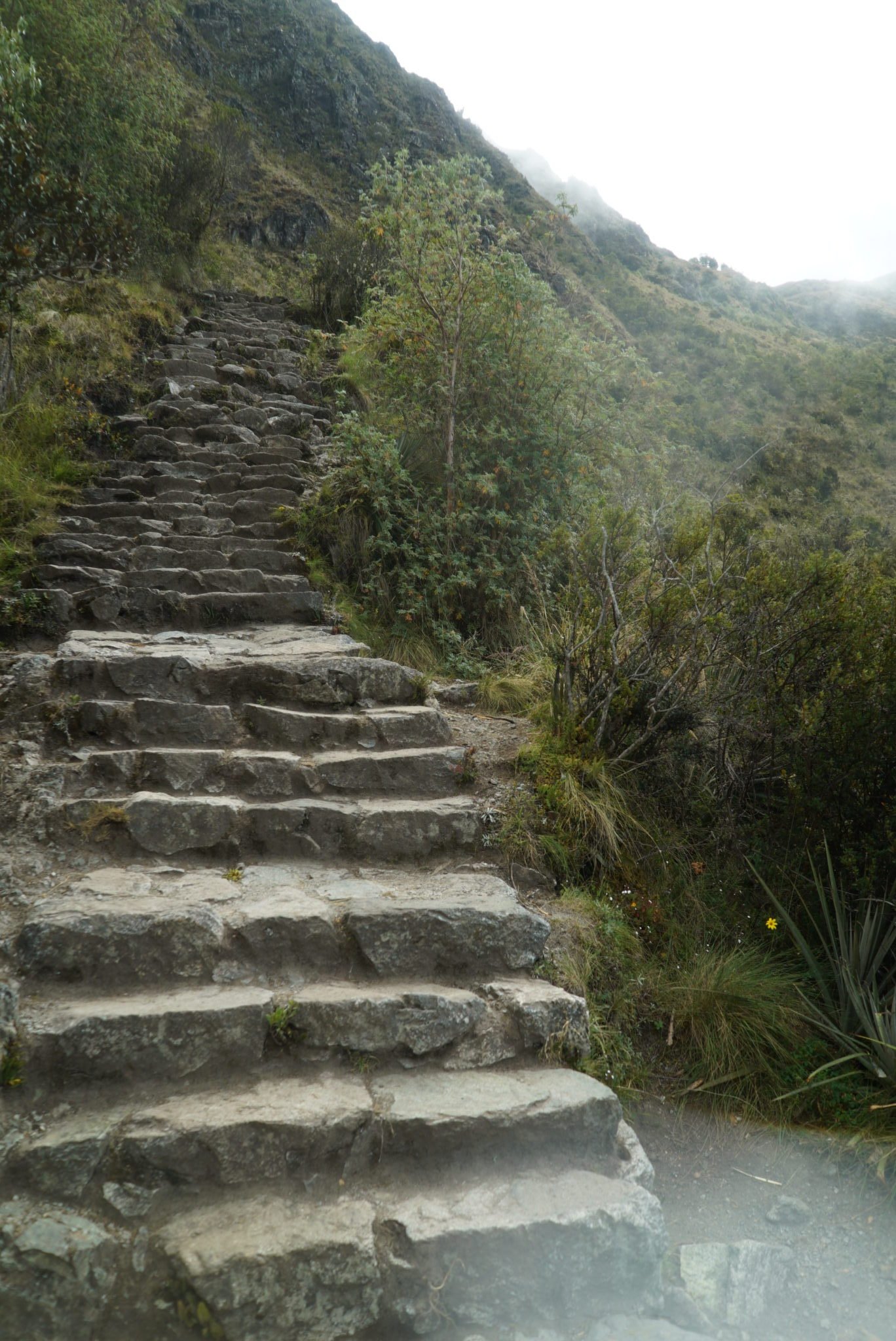
Katie and I woke to the "Hola" of one of our porters who served coca tea to our tent. We fueled up with another hearty meal before starting the hardest day of the trail. The hike started with a fairly steep 2,950 foot incline to Dead Woman's Pass. Throughout the day we were VERY thankful we brought knee braces and rented hiking poles as today's hike was seriously strenuous. Only thing we could do was to try not to think about it and focus on putting one foot ahead of the other (also trying not to fall off a cliff). We gladly took the opportunity to rest, eat a snack, and enjoy the extraordinary views from atop the pass. It was almost good enough to make us forget that the next part of the trail we would lose over 2,000 feet of the elevation we had just climbed and then immediately climb back up a very steep 1,423 feet to reach second pass. To breakup this up-down-up-down craziness, we had lunch before we started the incline to second pass. That break didn't last near long enough before we were back on the trail.
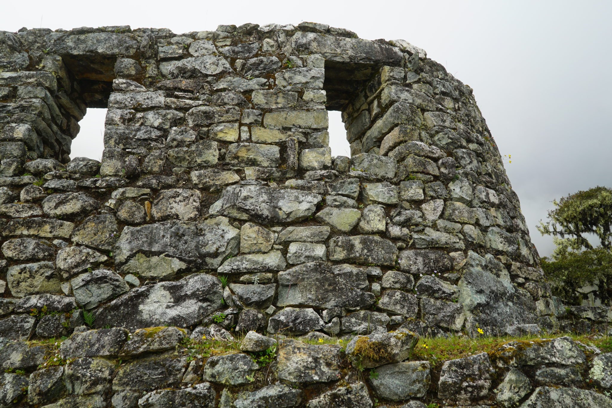
Near second pass, following a steep staircase off the trail, stood Sayaqmarka or 'Inaccessible City'. It is called that because the ruins sit precariously between three cliffs and is only accessible by these steep stairs. Because of the these features (and a lack of any arable terraces), it is thought this was a military fort or stronghold. Rosalio introduced us to our first example of Inca irrigation and water fountains. The Inca would locate a source of spring water high up in the mountains and then dig or carve out canals towards their cities. These canals would run through the city, typically next to the walkways, and at times run into 'water fountains'. These were square holes carved into the stone that would pool with a bit of water. Depending on the size of the city, there would be many of these fountains. Sayaqmarka was not an example of this, but we later visited ruins were the irrigation and water fountains were still fully functional! After hundreds of years of non-use and even returning to nature for a time, some of these systems continued working, bringing spring water to these ruins, through the canals, and pooling in the water fountains. At the entrance of Sayaqmarka, we could see the canal carved into the mountain side leading up to the city. At one time, there would have been a wooden canal to bridge the few meter gap to bring water into the city. Another interesting characteristic of the city was a large rock face that was naturally part of the mountain. The Inca tried as much as possible to build around nature and not to destroy it, especially when the nature resembled something. We would see several other iterations of this (particularly in Machu Picchu itself) where the natural shape of the rock face resembled a feature of a neighboring mountain. Because of this, the area around the feature was turned into a temple. This temple specifically was thought to be a temple of the sun.
On the topic of Inca military history, Katie and I learned that at it's peak the Inca population was around 15 million people. Around a hundred thousand of that population made up their military near the end. With those figures, you may be wondering how HUGE of a force the Spanish sent to conquer the Inca. Well...a sad truth is that the Spanish sent less than 200 soldiers, led by Francisco Pizarro, to 'deal' with the locals. If the Inca and the Spanish were to engage in open war with those figures, things most likely would have ended much differently. Unfortunately, the Inca were not in the best place having just followed a civil war (Two brothers, Huáscar and Atahualpa, split up the empire and fought each other for power), an epidemic of smallpox brought to Peru by the Spanish, and then Franscisco publicly executing Atahualpa (Interestingly for killing his brother) following being imprisoned after a 'peaceful' meeting between the two parties. This left the Inca weak and compartmentalized. Unfortunately, soon the Spanish would annihilate Inca leadership and take over the people.
Soon we were tramping on the trail once again, losing elevation and nearing our designated campsite. Along the way we enjoyed our first Inca tunnel. It was at about this point of extreme exhaustion and delirium that Rosalio asked if we would like to hike an extra few miles (extra hour and a half) so that we could watch the sun set at third pass. Compelled by the fact that we are "super hikers" (this was one of the kind things Rosalio lied to us to keep morale up), and the promise that sunset and sunrise at this campsite would definitely be worth it, we agreed and added to the hardest day of the hike. It paid off in two ways though. First, our third day of the hike was going to be incredibly easy now and second, we were able to enjoy a beautiful sunset from our vantage point above the clouds, on the mountains of Peru.
Inca Trail Day Two Itinerary:
5:30 AM - Wake Up
6:00 AM - Breakfast
6:30 AM - Hit the Trail
1:00 PM - Lunch
5:30 PM - Reach Campsite
6:00 PM - Dinner
Hike Info:
10.5 Miles
11.5 Hours
8148 Feet Elevation Change (Up and Down)
Major Ruins Seen:
Sayaqmarka